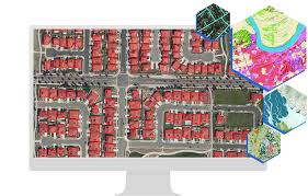
Unlocking Geospatial Insights with ArcGIS Machine Learning
ArcGIS Machine Learning: Revolutionizing Geospatial Analysis
In recent years, the integration of machine learning techniques into Geographic Information Systems (GIS) has transformed the way we analyse and interpret geospatial data. ArcGIS, a leading GIS software developed by Esri, has been at the forefront of this revolution with its powerful machine learning capabilities.
Machine learning algorithms in ArcGIS enable users to extract valuable insights from geospatial data by automatically identifying patterns, trends, and relationships that may not be apparent through traditional analytical methods. By leveraging machine learning, ArcGIS empowers users to make more informed decisions based on data-driven predictions and analysis.
One of the key advantages of using machine learning in ArcGIS is its ability to handle large volumes of complex spatial data efficiently. Whether it’s classifying land cover types, predicting urban growth patterns, or analysing environmental changes over time, ArcGIS machine learning algorithms can process vast amounts of geospatial information with speed and accuracy.
Furthermore, ArcGIS provides a user-friendly interface that allows both GIS professionals and non-experts to easily access and utilise machine learning tools. With intuitive workflows and built-in models, users can quickly train and deploy machine learning algorithms to address a wide range of geospatial challenges.
From environmental monitoring to urban planning to disaster response, the applications of ArcGIS machine learning are diverse and far-reaching. By harnessing the power of artificial intelligence and spatial analysis, organisations can unlock new insights, improve decision-making processes, and create more sustainable solutions for complex geospatial problems.
In conclusion, ArcGIS machine learning is revolutionising geospatial analysis by enabling users to extract meaningful insights from spatial data more effectively than ever before. As technology continues to advance, the integration of machine learning into GIS platforms like ArcGIS will undoubtedly play a crucial role in shaping the future of geospatial science and analysis.
7 Essential Tips for Mastering Machine Learning in ArcGIS
- Understand the basics of machine learning algorithms used in ArcGIS.
- Prepare your data carefully, ensuring it is clean and well-structured.
- Feature selection is crucial for improving model performance.
- Experiment with different models to find the best one for your specific task.
- Evaluate your model’s performance using appropriate metrics.
- Consider the interpretability of your model and communicate results effectively.
- Stay updated on new developments in ArcGIS machine learning capabilities.
Understand the basics of machine learning algorithms used in ArcGIS.
To make the most of ArcGIS machine learning capabilities, it is essential to have a solid understanding of the basics of machine learning algorithms employed within the software. By familiarising yourself with these fundamental concepts, such as classification, regression, clustering, and feature selection, you can effectively leverage ArcGIS to extract valuable insights from geospatial data. This knowledge will not only enhance your ability to interpret and utilise machine learning models in ArcGIS but also empower you to make informed decisions based on data-driven analysis.
Prepare your data carefully, ensuring it is clean and well-structured.
When utilising ArcGIS machine learning capabilities, it is crucial to prepare your data meticulously by ensuring it is clean and well-structured. Clean and well-structured data is essential for accurate model training and reliable results. By investing time in preparing your data properly, you can enhance the effectiveness of machine learning algorithms in ArcGIS, leading to more insightful analysis and informed decision-making based on reliable geospatial information.
Feature selection is crucial for improving model performance.
In the realm of ArcGIS machine learning, it is essential to highlight the significance of feature selection in enhancing model performance. By carefully choosing the most relevant and informative input variables, known as features, for training the machine learning model, users can improve its accuracy and efficiency in making predictions or classifications. Feature selection plays a pivotal role in reducing noise, improving model interpretability, and ultimately optimising the overall performance of machine learning algorithms within ArcGIS.
Experiment with different models to find the best one for your specific task.
When utilising ArcGIS machine learning, it is essential to experiment with various models to determine the most suitable one for your specific task. By exploring different algorithms and approaches, you can identify the model that best aligns with your data characteristics and analytical objectives. This iterative process of testing and refining models allows you to enhance the accuracy and effectiveness of your geospatial analysis, ultimately leading to more insightful and reliable results.
Evaluate your model’s performance using appropriate metrics.
When utilising ArcGIS machine learning, it is essential to evaluate your model’s performance using appropriate metrics. By assessing the accuracy, precision, recall, F1 score, or other relevant metrics specific to your geospatial analysis task, you can gain insights into how well your model is performing and identify areas for improvement. These evaluations help ensure that your machine learning model is effectively capturing patterns and making reliable predictions in the context of geospatial data analysis.
Consider the interpretability of your model and communicate results effectively.
When utilising ArcGIS machine learning tools, it is crucial to consider the interpretability of the model and effectively communicate the results obtained. Ensuring that the model’s predictions and insights are understandable to stakeholders is essential for informed decision-making and fostering trust in the analysis. By presenting findings in a clear and concise manner, users can better comprehend the implications of the model’s output and confidently act upon the information provided. Effective communication of results not only enhances the utility of ArcGIS machine learning but also promotes transparency and accountability in geospatial analysis processes.
Stay updated on new developments in ArcGIS machine learning capabilities.
To maximise the benefits of ArcGIS machine learning, it is crucial to stay informed about the latest advancements and updates in its capabilities. By keeping abreast of new developments in ArcGIS machine learning, users can take advantage of cutting-edge features and enhancements that may improve their geospatial analysis workflows. Regularly updating knowledge on ArcGIS machine learning ensures that users are equipped with the most up-to-date tools and techniques to extract valuable insights from geospatial data effectively.
